
navigation
by G.P.S
GPS as an illicit substance and how to
handle it without sinking into total dependency.
... if you can confine your habit to one of moderation, you may survive
and even prosper ...
reproduced from GASCO
For my part I use GPS all the time that I am flying
outside my local area and regard it as something almost magical in its
ability to solve navigational problems that used to take much cudgelling
of an overtaxed brain. What is your estimate for DUNNO?. an earnest
controller would ask. After the initial wave of panic and the shaming
response. Standby, (It is written that every proficient navigator
must always have to hand their estimate for the next three waypoints - so
what sort of navigator does that make me'?) I would then embark upon a
tortuous mental calculation that went something like:
My groundspeed is about 10' KTS and I should think that I am about here
(or might it be there?) If my first position is correct there is
about 21 miles to DUNNO but if it is the second it is only /6 miles: I
shall make a masterly compromise at 18. So it's 18 miles at 107 KTS and
Time equals Distance over Speed (or is it the other way around?). So 18
over 107 equals ...God Knows. lf it was 107 over 18 it would work out at
about five or six. But the answer must be in hours as knots are nautical
miles per hour. It ' can't be five or six hours. Or can it? Well
anyway - I do know that ' if I was flying at 120 KTS it would be half of
18 in minutes. That's nine minutes from when l was at where I thought that
I might be and that was at four minutes to and so my estimate should be a
bit after five minutes past. Say six minutes past. Past what? lf it's now
two minutes to twelve, French time, what's that in Zulu?
And so on. Such an innocent request from a controller
can take all the fun out of flying. These days I simply consult my GPS and
instantly respond: ', 10 minutes from now. However, everything
brings ', its own price and with GPS it is the risk of total dependency.
Yes, we are into illicit substances here.
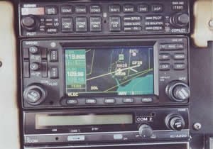
A Garmin 430. Common equipment for IFR aircraft
That nice avionics salesperson tempts you with such an
attractive little proposition. For about £300 you can have a proper
aviation hand held set and for half that a non aviation set that will be
just as accurate, but will not know where EGLL is unless you first tell
it. Give it a try, you'll
like it! Says the helpful
salesperson, and by golly, you will like it. In no time at all you
will be venturing out to distant places and scraping home in low scud
confident that your little friend knows just where you are, even if you
don't. Before long the craving will be luring you into moving maps,
colour, terrain and all the bells and whistles.
The thing is that if you can confine your habit to one
of moderation, you may survive and even prosper, but if you let it take
you over, so that you become a total dependant then, sooner or later, doom
awaits you. Doom in this instance will take the form of your finding
yourself overhead EGLL (London, Heathrow) when your magic little friend
has definitely assured you that you were nicely on track from Popham to
Biggin Hill - well, 0.3 miles right of track, to be precise.
In nine cases out of ten, it is not actually your
little friend's fault but yours. You entered some nonsense into the set
and it just did what you said. The most common fault is to get one of the
15 digits that make up a lat/long co-ordinate wrong. Or you might have
meant to enter EGKB (Biggin Hill) as your destination but absentmindedly
entered EGSG (Stapleford). Mistakes of this sort are easily and often
made. Much less often, it's your little friend lets you down. It runs out
of batteries or satellite signals and dies on you. At least you will then
be aware that all is not well but very occasionally it will mislead you in
spite of your fingers having pressed all the right buttons and in the
right order too.
Thus, you cannot rely totally on GPS because
occasionally it will mislead you. Consequently you must always run some
other navigation system as a check, which is a bit of a pain when you
thought that all your navigation problems had been solved. Nonetheless, if
you are to avoid all the unpleasantness that follows busting controlled
airspace, you have to keep running that check.
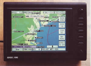
A Bendix/King Skymap Ill. Easier to use and less error prone than earlier
or simpler sets
For IFR pilots your check system will probably be VOR/DME
and if you have an RNAV set it will mean merely entering your waypoints in
your RNAV set as well as your GPS set and making sure that both sets are
giving you the same information. Without RNAV you will need to check VOR/DME
co-ordinates from time to time.
For VFR pilots, I'm afraid it's back to the old map
reading, watch and compass. Here are a few tips:
1 Enter the route in your GPS set the night before.
This gives you time to draw track lines on your map, construct your PLOG,
check that you have entered your waypoints correctly and familiarise
yourself with your GPS set once more. If your set is panel mounted, get a
software simulator of your GPS for your PC and set up the route on that
the night before.
2 Avoid lat/long co-ordinates and use instead bearing
and distance from somewhere already in your database. Thus if, say, the
south western end of the twin canals in Cambridgeshire is a waypoint, it
is much easier to define and enter this as 001 deg and 22 nm from BKY
than it is to deal with N522133E0000215. Furthermore, in the air, when
the brain atrophies, 22 miles North of Barkway means something that you
can quickly check, while those 15 co-ordinates mean nothing.
3 Choose waypoints and routes that are easily
recognisable from the air, even though that means creating User
Waypoints.
4 If you can use a 'second generation' GPS set, such as
a Bendix/King Skymap III with a large moving map and a joystick for moving
a pointer around so as quickly to define waypoints, you will be
considerably less error prone.
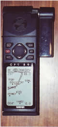
A handheld GPS set
If you keep your visual navigation going alongside
your, GPS nav. you will soon detect when things are not as they should be
and in this way you will cleverly avoid the dreaded consequences of
over dependence. If you also keep in contact with a controller
providing a Radar Information or Flight Information service they can often
save you from the error of your ways before things get serious. With GPS,
plus a visual nav. check plus an information, service your navigation
should be foolproof.
Nigel Everett |
