|
|

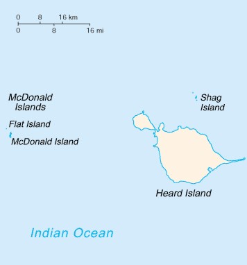
Heard Island and McDonald Islands

|
Background:
|
These uninhabited, barren,
sub-Antarctic islands were transferred from the UK to Australia in
1947. Populated by large numbers of seal and bird species, the
islands have been designated a nature preserve. |
|
Location: |
islands in the Indian Ocean, about
two-thirds of the way from Madagascar to Antarctica |
|
Geographic
coordinates: |
53 06 S, 72 31 E |
|
Area: |
total:
412 sq km
land: 412 sq km
water: 0 sq km |
|
Land boundaries:
|
0 km |
|
Coastline:
|
101.9 km |
|
Maritime claims:
|
territorial sea:
12 nm
exclusive fishing zone: 200 nm |
|
Climate:
|
Antarctic |
|
Terrain:
|
Heard Island - 80% ice-covered, bleak
and mountainous, dominated by a large massif (Big Ben) and an active
volcano (Mawson Peak); McDonald Islands - small and rocky
|
|
Elevation extremes:
|
lowest point:
Indian Ocean 0 m
highest point: Mawson Peak, on Big Ben 2,745 m |
|
Natural resources:
|
fish |
|
Land use:
|
arable land:
0%
permanent crops: 0%
other: 100% (2005) |
|
Irrigated land:
|
0 sq km |
|
Natural hazards:
|
Mawson Peak, an active volcano, is on
Heard Island |
|
Population:
|
uninhabited (July 2006 est.)
|
|
Country name:
|
conventional long form:
Territory of Heard Island and McDonald Islands
conventional short form: Heard Island and McDonald Islands
|
|
Dependency lstatus:
|
territory of Australia; administered
from Canberra by the Australian Antarctic Division of the Department
of the Environment and Heritage |
|
Legal system:
|
the laws of Australia, where
applicable, apply |
|
Flag description:
|
the flag of Australia is used
|
|
Economy - overview:
|
No indigenous economic activity, but
the Australian Government allows limited fishing around the islands.
|
|
Ports and terminals:
|
none; offshore
anchorage only |
|
Military - note:
|
defence is the
responsibility of Australia; Australia conducts fisheries patrols
|
|
Disputes -
international:
|
none |
|
|
