|
|
|
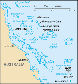
Scattered over some 1 million square
kilometers of ocean, the Coral Sea Islands were declared a territory of
Australia in 1969. They are uninhabited except for a small meteorological
staff on the Willis Islets. Automated weather stations, beacons, and a
lighthouse occupy many other islands and reefs. Oceania, islands in the Coral Sea,
northeast of Australia 18 00 S, 152 00 E Oceania total: less
than 3 sq km tropical sand and coral reefs and islands (or cays)
lowest point:
Pacific Ocean 0 m 0 sq km (1998 est.) occasional tropical cyclones no permanent fresh water resources
important nesting area for birds and
turtles no indigenous inhabitants territory of Australia; administered from
Canberra by the Department of the Environment, Sport, and Territories
the laws of Australia, where applicable,
apply no economic activity there are automatic weather stations on
many of the isles and reefs relaying data to the mainland none; offshore anchorage only defense is the responsibility of
Australia; visited regularly by the Royal Australian Navy; Australia has
control over the activities of visitors |
|
|