|
|
|
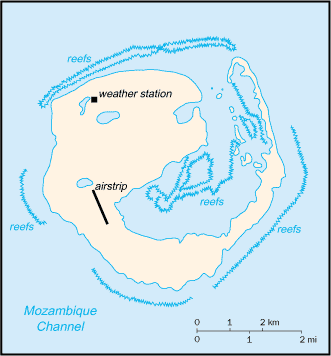
A French possession since 1897, the island
is heavily wooded; it is the site of a small military garrison that staffs a
weather station. Southern Africa, island in the Mozambique
Channel, about one-half of the way from southern Madagascar to southern
Mozambique 22 20 S, 40 22 E total: 28 sq
km tropical low and flat lowest point:
Indian Ocean 0 m wildlife sanctuary no indigenous inhabitants possession of France; administered by a
high commissioner of the Republic, resident in Reunion the laws of France, where applicable,
apply no economic activity 1 meteorological station none; offshore anchorage only 1 (2003 est.) total: 1 defense is the responsibility of France
claimed by Madagascar |
|
|